Tuesday, 7 January 2025

1510 MX - Archipiélago de Revillagigedo (2016)

Located in the eastern Pacific Ocean, this archipelago is made up of four remote islands and their surrounding waters: San Benedicto, Socorro, Roca Partida and Clarión. This archipelago is part of a submerged mountain range, with the four islands representing the peaks of volcanoes emerging above sea level. The islands provide critical habitat for a range of wildlife and are of particular importance for seabirds. The surrounding waters have a remarkable abundance of large pelagic species, such as manta rays, whales, dolphins and sharks. 

Revillagigedo群岛

这片群岛位于太平洋东部,由四座岛屿及其周边水域组成:圣贝内迪克托、索科罗、罗卡帕蒂达和克拉里翁岛。群岛是海底山脉的组成部分,露出水面的海底火山顶就是岛屿。群岛为海鸟等许多野生物种提供了重要的栖息地。岛屿周边水域中生活着巨型鬼蝠鲼、鲸鱼、海豚和鲨鱼等丰富多样的大型浅水物种。

Source UNESCO WH website http://whc.unesco.org/en/list/1510

  • 1510-001 Isla Socorro
  • 1510-002 Isla Clarion
  • 1510-003 Isla San Benedicto
  • 1510-004 Isla Roca Partida

1510-003 Isla San Benedicto

1270 CU - Historic Centre of Camagüey (2008)

Historic Centre of Camagüey

One of the first seven villages founded by the Spaniards in Cuba, Camagüey played a prominent role as the urban centre of an inland territory dedicated to cattle breeding and the sugar industry. Settled in its current location in 1528, the town developed on the basis of an irregular urban pattern that contains a system of large and minor squares, serpentine streets, alleys and irregular urban blocks, highly exceptional for Latin American colonial towns located in plain territories. The 54 ha Historic Centre of Camagüey constitutes an exceptional example of a traditional urban settlement relatively isolated from main trade routes. The Spanish colonizers followed medieval European influences in terms of urban layout and traditional construction techniques brought to the Americas by their masons and construction masters. The property reflects the influence of numerous styles through the ages: neoclassical, eclectic, Art Deco, Neo-colonial as well as some Art Nouveau and rationalism.

Source UNESCO WH website http://whc.unesco.org/en/list/1270

1550 ER - Asmara: A Modernist African City (2017)

 Asmara: A Modernist African City

Located at over 2,000 m above sea level, the capital of Eritrea developed from the 1890s onwards as a military outpost for the Italian colonial power. After 1935, Asmara underwent a large scale programme of construction applying the Italian rationalist idiom of the time to governmental edifices, residential and commercial buildings, churches, mosques, synagogues, cinemas, hotels, etc. The property encompasses the area of the city that resulted from various phases of planning between 1893 and 1941, as well as the indigenous unplanned neighbourhoods of Arbate Asmera and Abbashawel. It is an exceptional example of early modernist urbanism at the beginning of the 20th century and its application in an African context.

Source UNESCO WH website http://whc.unesco.org/en/list/1550

9 ET - Simien National Park (1978)

 Simien National Park

Massive erosion over the years on the Ethiopian plateau has created one of the most spectacular landscapes in the world, with jagged mountain peaks, deep valleys and sharp precipices dropping some 1,500 m. The park is home to some extremely rare animals such as the Gelada baboon, the Simien fox and the Walia ibex, a goat found nowhere else in the world.

塞米恩国家公园

多少年以来,埃塞俄比亚高原遭受了严重侵蚀,但侵蚀也造就了世界上最为壮观的奇景之一,这里山峰险峻,峡谷幽深,悬崖峭壁高达1500米。公园也是一些极珍稀动物的栖息地,比如杰拉达狒狒、塞米恩狐狸和世界上仅此一处的瓦利亚野生山羊。

Source UNESCO WH website http://whc.unesco.org/en/list/9

1263 YE - Socotra Archipelago (2008)

 Socotra Archipelago

Socotra Archipelago, in the northwest Indian Ocean near the Gulf of Aden, is 250 km long and comprises four islands and two rocky islets which appear as a prolongation of the Horn of Africa. The site is of universal importance because of its biodiversity with rich and distinct flora and fauna: 37% of Socotra’s 825 plant species, 90% of its reptile species and 95% of its land snail species do not occur anywhere else in the world. The site also supports globally significant populations of land and sea birds (192 bird species, 44 of which breed on the islands while 85 are regular migrants), including a number of threatened species. The marine life of Socotra is also very diverse, with 253 species of reef-building corals, 730 species of coastal fish and 300 species of crab, lobster and shrimp.

Source UNESCO WH website http://whc.unesco.org/en/list/1263

MW1419 - Mulanje Mountain Biosphere Reserve (2000)


877 NZ - New Zealand Sub-Antarctic Islands (1998)

 New Zealand Sub-Antarctic Islands

The New Zealand Sub-Antarctic Islands consist of five island groups (the Snares, Bounty Islands, Antipodes Islands, Auckland Islands and Campbell Island) in the Southern Ocean south-east of New Zealand. The islands, lying between the Antarctic and Subtropical Convergences and the seas, have a high level of productivity, biodiversity, wildlife population densities and endemism among birds, plants and invertebrates. They are particularly notable for the large number and diversity of pelagic seabirds and penguins that nest there. There are 126 bird species in total, including 40 seabirds of which eight breed nowhere else in the world.

新西兰次南极区群岛

新西兰次南极区群岛包括了新西兰南部和东南部海域的五个岛屿(斯内斯群岛、邦提群岛、安提波德斯群岛、奥克兰群岛和坎贝尔岛)。这些岛屿位于南极和亚热带之间的海域,具有富饶的资源和多种多样的生物,包括野生动植物、特殊的鸟类、植物以及无脊椎动物。这里最值得注意的是有大量的、种类繁多的远洋海鸟和在那里筑巢的企鹅。这里共有126种鸟类,包括40种海鸟,其中8种是世界上其他地方所没有的。

Source UNESCO WH website http://whc.unesco.org/en/list/877

  • 877-001 The Snares
  • 877-002 Bounty Islands
  • 877-003 Antipodes Islands
  • 877-004 Auckland Islands
  • 877-005 Campbell Island
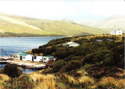
877-001 The Snares
877-002 Bounty Islands
877-004 Auckland Islands

877-005 Campbell Island

Monday, 6 January 2025

1707 FR - Te Henua Enata – The Marquesas Islands (2024)

Te Henua Enata – The Marquesas Islands

Located in the South Pacific Ocean, this mixed serial property bears an exceptional testimony to the territorial occupation of the Marquesas archipelago by a human civilisation that arrived by sea around the year 1000 CE and developed on these isolated islands between the 10th and the 19th centuries. It is also a hotspot of biodiversity that combines irreplaceable and exceptionally well conserved marine and terrestrial ecosystems. Marked by sharp ridges, impressive peaks and cliffs rising abruptly above the ocean, the landscapes of the archipelago are unparalleled in these tropical latitudes. The archipelago is a major centre of endemism, home to rare and diverse flora, a diversity of emblematic marine species, and one of the most diverse seabird assemblages in the South Pacific. Virtually free from human exploitation, Marquesan waters are among the world’s last marine wilderness areas. The property also includes archaeological sites ranging from monumental dry-stone structures to lithic sculptures and engravings.

人类之地——马克萨斯群岛

马克萨斯(Marquesas)群岛位于南太平洋。公元1000年前后,人类从海上抵达这些偏远岛屿。该混合系列遗产是这一过程及其于10-19世纪间的繁衍生息的绝佳例证。这里也是生物多样性热点地区,拥有无可替代、保存完好的海洋和陆地生态系统。群岛以陡峭的山脊、雄伟的山峰和高耸的临海峭壁为特色,其自然景观在同纬度热带地区无与伦比。它是重要的特有物种中心,拥有珍稀且多样的植物、丰富的标志性海洋物种,以及南太平洋种类最为繁多的海鸟种群。马克萨斯水域几乎未经人类开发,是世界上所剩不多的海洋荒野区。岛上还保留着大型干砌石结构、石雕、石刻等考古遗迹。

Source UNESCO WH website http://whc.unesco.org/en/list/1707

  • 1707-001 Ensemble mixte de Eiao-Hatu Tu
  • 1707-002 Ensemble mixte de Nuku Hiva
  • 1707-003 Ensemble mixte de Ua Pou
  • 1707-004 Aire marine côtière de Ua Huka
  • 1707-005 Ensemble mixte de Hiva Oa-Tahuata
  • 1707-006 Ensemble mixte de Fatu Uku
  • 1707-007 Ensemble mixte de Fatu Iva
02- Nuku Hiva
03 - Ua Pou
05 - Hiva Oa

1548 BR - Valongo Wharf Archaeological Site (2017)

Valongo Wharf Archaeological Site is located in central Rio de Janeiro and encompasses the entirety of Jornal do Comércio Square. It is in the former harbour area of Rio de Janeiro in which the old stone wharf was built for the landing of enslaved Africans reaching the South American continent from 1811 onwards. An estimated 900,000 Africans arrived in South America via Valongo. The site is composed of several archaeological layers, the lowest of which consists of floor pavings in pé de moleque style, attributed to the original Valongo Wharf. It is the most important physical trace of the arrival of African slaves on the American continent.

Source UNESCO WH website http://whc.unesco.org/en/list/1548

Courtesy of Fabiana1 from postcrossing forum


with the matching stamp of Valongo

Sunday, 29 December 2024

1611 BR - Lençóis Maranhenses National Park (2024)

Lençóis Maranhenses National Park

The property is located in northeastern Brazil, on the east coast of Maranhão, in a transition zone between three Brazilian biomes: Cerrado, Caatinga and Amazon. More than half of its area consists of a white coastal dune field with temporary and permanent lagoons. Beyond its important role in biodiversity conservation, the park boasts globally significant aesthetic and geological / geomorphological values. Along an 80 km coastline, with beaches followed by plains, the prevailing winds shape the dunes into long chains of barchans, filled in the rainy season to create lagoons of various colours, shapes, sizes and depths. The property reveals its best scenery when the lagoons reach their maximum volume, creating rare beauty. The vast expanse of both stable and shifting dunes, the largest in South America, presents remarkable evidence of the evolutionary progression of coastal dunes throughout the Quaternary period.

伦索伊斯-马拉年塞斯国家公园

伦索伊斯-马拉年塞斯(Lençóis Maranhenses)国家公园位于巴西东北部的马拉尼昂州东海岸,地处塞拉多、卡廷加、亚马逊3大巴西生物群系间的过渡地带。白色海岸沙丘地带占据了其过半面积,其中包括永久性和临时性潟湖。公园不仅在保护生物多样性方面发挥重要作用,还具有世界级美学和地质/地貌价值。80公里的海岸线由沙滩覆盖,尽头则是平原。沙丘被盛行风塑造成长长的新月形沙丘链。雨季来临时,沙丘之间的洼地会被雨水填满,形成颜色、形状、大小、深浅各异的潟湖。蓄水量达到顶点时,公园景色美不胜收。这里拥有南美洲面积最大的固定沙丘和移动沙丘,为第4纪海岸沙丘的演变过程提供了出色例证。

Source UNESCO WH website http://whc.unesco.org/en/list/1611

Courtesy of Fabiana1 from postcrossing forum


1620 BR - Sítio Roberto Burle Marx (2021)

Situated in the western region of Rio de Janeiro, the property embodies a successful project developed over more than 40 years by landscape architect and artist Roberto Burle Marx (1909-1994), a “landscape laboratory” to create “living works of art” using native plants and drawing on Modernist ideas. Began in 1949, the property encompasses extensive landscapes, gardens, buildings and collections, which feature the key characteristics that came to define Burle Marx’s landscape gardens and influenced the development of modern gardens internationally. The site is characterized by sinuous forms, exuberant mass planting, architectural plant arrangements, dramatic colour contrasts, use of tropical plants, and the incorporation of elements of traditional folk culture. By the end of the 1960s, the site housed the most representative collection of Brazilian plants, alongside other rare tropical species. In the site, 3,500 cultivated species of tropical and subtropical flora grow in harmony with the native vegetation of the region, notably the Atlantic Forest biome and associated ecosystems, mangrove swamp and restinga (coastal tropical sandy plain). Sítio Roberto Burle Marx exhibits an ecological conception of form as a process, including social collaboration which is the basis for environmental and cultural preservation. It comprises the first modern tropical garden to be inscribed on the World Heritage List.

罗伯托·布雷·马克思庄园

该遗产地位于里约热内卢以西,主体为巴西景观设计大师、艺术家罗伯托·布雷·马克思(Roberto Burle Marx,1909-1994)历时40多年开发的一个成功项目。他运用本土植物,借鉴现代主义思潮,打造了一个“活的艺术作品”兼“景观实验室”。自1949年起,该庄园就拥有日后界定马克思园林的关键特征,并影响了现代园林的国际化发展。其特点包括弯曲的造型、多且茂盛的植被、符合建筑学规范的植物配置、强烈的色彩对比、热带植物的运用,以及传统民俗文化元素的融入。到20世纪60年代末,庄园已收集最具代表性的巴西植物,以及其它稀有热带物种。3500种热带和亚热带植物栽培品种与本土原生植被在这里和谐共生,多见原生植被有红树林沼泽、雷斯廷加(一种独特的热带和亚热带海岸湿润阔叶林)和大西洋森林。庄园展示了形式即过程的生态概念,包括作为环境和文化保护基础的社会协作。它是第一个被列入世界遗产名录的现代热带园林。

Source UNESCO WH website http://whc.unesco.org/en/list/1620

Courtesy of Fabiana1 from postcrossing forum


Thursday, 12 December 2024

1720 KE - The Historic Town and Archaeological Site of Gedi (2024)

The Historic Town and Archaeological Site of Gedi

Surrounded by a remnant coastal forest, away from the coastline, the abandoned city of Gedi was one of the most important Swahili cities on the East African coast from the 10th to 17th centuries. During this period, it was part of a complex and international network of trade and cultural exchanges that crossed the Indian Ocean, linking African coastal centres with Persia and other areas. The opulent settlement is clearly delineated by walls and features remains of domestic, religious, and civic architecture, and a sophisticated water management system. It strongly represents the characteristics of Swahili architecture and town planning, utilising materials such as coral rag, coral and earth mortar and wood.

格迪古镇和考古遗址

被遗弃的格迪(Gedi)古镇离海不远,四周残存的沿海森林将其与海岸隔开。10-17世纪,它曾是东非海岸最重要的斯瓦希里城市之一。那段时间里,格迪是横跨印度洋的复杂国际贸易和文化交流网络的一部分,参与将非洲沿海中心与波斯和其他地区连接起来。城墙清晰地勾勒出这一富饶市镇的轮廓,其中保留着民居、宗教、城镇建筑遗迹,以及先进的水务系统。格迪古镇充分体现了斯瓦西里建筑和城市规划的特色,其使用的建筑材料包括珊瑚石灰岩、珊瑚砂浆、土砂浆、木材等。

Source UNESCO WH website http://whc.unesco.org/en/list/1720

Tuesday, 10 December 2024

1603 FR - French Austral Lands and Seas (2019)

 French Austral Lands and Seas

The French Austral Lands and Seas comprise the largest of the rare emerged landmasses in the southern Indian Ocean: the Crozet Archipelago, the Kerguelen Islands, Saint-Paul and Amsterdam Islands as well as 60 small sub-Antarctic islands. This ‘oasis’ in the middle of the Southern Ocean covers an area of more than 166 million ha and supports one of the highest concentrations of birds and marine mammals in the world. In particular, it has the largest population of King Penguins and Yellow-nosed albatrosses in the world. The remoteness of these islands from centres of human activity makes them extremely well-preserved showcases of biological evolution and a unique terrain for scientific research.

法属南部领地和领海

该遗产地包括陆地稀少的南印度洋上最大的几个群岛和岛屿:克罗泽群岛、凯尔盖朗群岛、圣保罗岛和阿姆斯特丹岛,以及约60个小型亚南极岛屿。这片南半球海域上的“绿洲”总计占地16600万公顷,是全世界鸟类和海洋哺乳动物密度最高的地区之一,尤其帝企鹅和黄鼻信天翁数量居全球之冠。由于远离人类活动中心,这些岛屿保存状态完好,是生物演变历程的陈列馆和科学研究的独特场所。

Source UNESCO WH website http://whc.unesco.org/en/list/1603

  • 1603bis-001 Crozet
  • 1603bis-002 Kerguelen
  • 1603bis-003 Saint-Paul et Amsterdam


1603bis-002 Kerguelen

1603bis-003 Saint-Paul et Amsterdam


Wednesday, 4 December 2024

1645 IN - Dholavira: a Harappan City (2021)

 Dholavira: a Harappan City

The ancient city of Dholavira, the southern centre of the Harappan Civilization, is sited on the arid island of Khadir in the State of Gujarat. Occupied between ca. 3000-1500 BCE, the archaeological site, one of the best preserved urban settlements from the period in Southeast Asia, comprises a fortified city and a cemetery. Two seasonal streams provided water, a scarce resource in the region, to the walled city which comprises a heavily fortified castle and ceremonial ground as well as streets and houses of different proportion quality which testify to a stratified social order. A sophisticated water management system demonstrates the ingenuity of the Dholavira people in their struggle to survive and thrive in a harsh environment. The site includes a large cemetery with cenotaphs of six types testifying to the Harappan’s unique view of death. Bead processing workshops and artifacts of various kinds such as copper, shell, stone, jewellery of semi-precious stones, terracotta, gold, ivory and other materials have been found during archaeological excavations of the site, exhibiting the culture’s artistic and technological achievements. Evidence for inter-regional trade with other Harappan cities, as well as with cities in the Mesopotamia region and the Oman peninsula have also been discovered. 

多拉维拉:哈拉帕文明古城

多拉维拉古城是哈拉帕文明的南部中心,位于古吉拉特邦干旱的卡迪尔岛上。该考古遗址在大约公元前3000-1500年间为人类定居点,由一座设防的城市和一片墓地组成,是这一时期保存最完好的东南亚城镇定居点之一。两条季节性溪流为这座带有城墙保护的古城提供了该地区稀缺的水资源。古城包括戒备森严的城堡、仪式场地,以及不同级别的街道和房屋,呈现出等级分明的社会秩序。复杂的用水管理系统展示了多拉维拉人在恶劣环境中生存和发展的聪明才智。该遗址还包括一个大型墓地,6种类型的墓碑诠释了哈拉帕文明对死亡的独特见解。考古工作者发掘出珠子加工作坊及由铜、贝壳、石头、半宝石首饰、陶土、黄金、象牙等材料制成的各种文物,展示了该文明的艺术和技艺成就。他们还发现了此地与其他哈拉帕文明城市以及美索不达米亚地区、阿曼半岛的城市进行区域间贸易的证据。

Source UNESCO WH website http://whc.unesco.org/en/list/1645

Courtesy of kraghavendrabhat from postcrossing forum

Tuesday, 3 December 2024

1570 IN - Kakatiya Rudreshwara (Ramappa) Temple, Telangana (2021)

 Kakatiya Rudreshwara (Ramappa) Temple, Telangana

Rudreshwara, popularly known as Ramappa Temple, is located in the village of Palampet approximately 200km north-east of Hyderabad, in the State of Telangana. It is the main Shiva temple in a walled complex built during the Kakatiyan period (1123–1323 CE) under rulers Rudradeva and Recharla Rudra. Construction of the sandstone temple began in 1213 CE and is believed to have continued over some 40 years. The building features decorated beams and pillars of carved granite and dolerite with a distinctive and pyramidal Vimana (horizontally stepped tower) made of lightweight porous bricks, so-called ‘floating bricks’, which reduced the weight of the roof structures. The temple’s sculptures of high artistic quality illustrate regional dance customs and Kakatiyan culture. Located at the foothills of a forested area and amidst agricultural fields, close to the shores of the Ramappa Cheruvu, a Kakatiya-built water reservoir, the choice of setting for the edifice followed the ideology and practice sanctioned in dharmic texts that temples are to be constructed to form an integral part of a natural setting, including hills, forests, springs, streams, lakes, catchment areas, and agricultural lands.

特伦甘纳邦的卡卡提亚王朝卢德什瓦拉(拉玛帕)神庙

卢德什瓦拉,俗称拉玛帕神庙,位于特伦甘纳邦海得拉巴市东北约200公里处的帕拉姆佩特村。它是一个由围墙围绕的建筑群中的主要湿婆神庙,建于卡卡提亚王朝(公元1123-1323年)鲁德拉德瓦(Rudradeva)和鲁德拉(Recharla Rudra)统治时期。这座砂岩神庙始建于公元1213年,据信施工持续了约40年。其特点是由花岗岩和大理岩雕刻而成的梁柱,和一个独特的、金字塔形状的屋顶塔(水平阶梯塔)。塔由被称为“浮砖”的轻质多孔砖搭建而成,从而减轻了屋顶结构的重量。拉玛帕神庙的雕塑具有很高艺术水准,形象地展示了当地的舞蹈习俗及卡卡提亚文化。神庙位于林木茂盛的山丘和农田之中,靠近拉玛帕湖(卡卡提亚时期建造的水库), 建筑环境的选择遵循达摩经文中的思想和实践,即神庙的建造应成为包括山丘、森林、泉水、溪流、湖泊、集水区和农田在内的自然环境的组成部分。

Source UNESCO WH website http://whc.unesco.org/en/list/1570

Courtesy of kraghavendrabhat from postcrossing forum

815 MX - Hospicio Cabañas, Guadalajara (1997)

Hospicio Cabañas, Guadalajara

The Hospicio Cabañas was built at the beginning of the 19th century to provide care and shelter for the disadvantaged – orphans, old people, the handicapped and chronic invalids. This remarkable complex, which incorporates several unusual features designed specifically to meet the needs of its occupants, was unique for its time. It is also notable for the harmonious relationship between the open and built spaces, the simplicity of its design, and its size. In the early 20th century, the chapel was decorated with a superb series of murals, now considered some of the masterpieces of Mexican art. They are the work of José Clemente Orozco, one of the greatest Mexican muralists of the period.

瓜达拉哈拉的卡瓦尼亚斯救济所

19世纪初期,在瓜达拉哈拉修建起了卡瓦尼亚斯救济所,用来照顾和庇护那些生活有困难的人们,如孤儿、老人、残疾人以及慢性病患者。这个救济所在当时是绝无仅有的一个,它的设计包含了许多特殊的考虑,以满足那些生活困难人群的特殊要求。这个救济所还因为室内外空间的和谐、简约的设计和它的规模而举世闻名。在20世纪初期,这里的小教堂内装饰有许多精美的壁画,很多现在被认为是墨西哥艺术中的杰作,它们出自当时最著名的墨西哥壁画画家何塞·克莱门蒂·奥罗斯科之手。

Source UNESCO WH website http://whc.unesco.org/en/list/815

Courtesy of silentcity from postcrossing forum

1688 RU - Cultural Landscape of Kenozero Lake (2024)

Located in Kenozero National Park in the north-western area of the European region of the Russian Federation, the property depicts the local cultural landscape that evolved here from the 12th century, following the gradual Slavic colonization. It incorporates a number of traditional rural settlements with vernacular wooden architecture and reflects the communal management of agriculture and nature that developed when the indigenous Finno-Ugric forest culture merged with the traditional Slavic field culture. Wooden churches and other religious buildings, originally decorated with painted ceilings, or “heavens”, are the key social, cultural, and visual landmarks of the area. Their spatial organization, together with sacred sites and symbols, highlight the residents’ spiritual connection with this environment.

克诺泽罗湖区历史见证

该遗产地位于欧洲俄罗斯西北部的克诺泽罗(Kenozero)国家公园内,展现了12世纪以来当地逐渐被斯拉夫人殖民后形成的文化景观。这里有许多传统的乡村民居和乡土木质建筑,反映了芬兰—乌戈尔森林原住民文化和传统斯拉夫田野文化融合产生的农业与自然协同管理模式。木质教堂等宗教建筑是该地区重要的社会、文化、景观地标,最初安装有被称作“天堂”的彩绘天花板。这些建筑的空间构成结合其他宗教遗存和象征标志,共同突出了居民与环境的精神联结。

Source UNESCO WH website http://whc.unesco.org/en/list/1688

Courtesy of ksimonova2013 from postcrossing forum
Chapel of St Nicholas, the wonderworker in Vershinino

1187 BY/EE/FI/LT/MD/NO/RU/UA - Struve Geodetic Arc (2005)

Brief Description

"The Struve Arc is a chain of survey triangulations stretching from Hammerfest in Norway to the Black Sea, through 10 countries and over 2,820 km. These are points of a survey, carried out between 1816 and 1855 by the astronomer Friedrich Georg Wilhelm Struve, which represented the first accurate measuring of a long segment of a meridian. This helped to establish the exact size and shape of the planet and marked an important step in the development of earth sciences and topographic mapping. It is an extraordinary example of scientific collaboration among scientists from different countries, and of collaboration between monarchs for a scientific cause. The original arc consisted of 258 main triangles with 265 main station points. The listed site includes 34 of the original station points, with different markings, i.e. a drilled hole in rock, iron cross, cairns, or built obelisks."

斯特鲁维地理探测弧线
"斯特鲁维地理探测弧线是一个三角测量链,北起挪威哈 默菲斯特(Hammerfest),南至黑海,弧线穿越十个国家,长2820公里。弧线是天文学家弗里德理西·格奥尔格·威廉·斯特鲁维 (Friedrich Georg Wilhelm Struve)于1816至1855年期间进行测量的测量点,代表着人类首次对子午线长短的精确测量。这一测量帮助人类掌握了地球的确切大小和形状,是地 球科学和地形绘图学发展中的重要一步。这个弧线不仅是多国科学家通力合作的一个特例,也是多国君主为科学事业联袂协作的一个特例。原始弧线包含258个主 要三角形和265个测量站点。列入世界遗产名录的弧有34个原始测量站点,带有各种不同标记,如岩石钻孔、铁十字、堆石标或方尖石碑。"

Source UNESCO WH website http://whc.unesco.org/en/list/1187

1187-001 FUGLENAES Fuglenes,Hammerfest, Finnmark, Norway N70 40 12.00 E23 39 48.00
1187-002 LILLE-REIPAS Raipas,Alta, Finnmark, Norway N69 56 19.00 E23 21 37.00
1187-003 LOHDIZHJOKKI Luvdiidcohkka,Kautokeino, Finnmark, Norway N69 39 52.00 E23 36 8.00     
1187-004 BÄLJATZ-VAARA Baelljasvarri,Kautokeino, Finnmark, Norway N69 1 43.00 E23 18 19.00
1187-005 PAJTAS-VAARA Tynnyrilaki,Kiruna, Norrbottens län, Sweden N68 15 18.00 E22 58 59.00
1187-006 KERROJUPUKKA Jupukka,Pajala, Norrbottens län, Sweden N67 16 36.00 E23 14 35.00
1187-007 PULLINKI Pullinki,Övertorneå, Norrbottens län, Sweden N66 38 47.00 E23 46 55.00
1187-008 PERRA-VAARA Perävaara,Haparanda, Norrbottens län, Sweden N66 1 5.00 E23 55 21.00
1187-009 STUOR-OIVI Stuorrahanoaivi,Enontekiö, Lapin lääni, Finland N68 40 57.00 E22 44 45.00    
1187-010 AVASAKSA Aavasaksa,Ylitornio, Lapin lääni, Finland N66 23 52.00 E23 43 31.00
1187-011 TORNEA Alatornion kirkko,Tornio, Lapin lääni, Finland N65 49 48.00 E24 9 26.00
1187-012 PUOLAKKA Oravivuori,Korpilahti, Länsi-Suomen lääni, Finland N61 55 36.00 E25 32 1.00

1187-013 PORLOM II Tornikallio,Lapinjärvi, Etelä-Suomen lääni, Finland N60 42 17.00 E26 0 12.00
1187-014 SVARTVIRA Mustaviiri,Pyhtää, Etelä-Suomen lääni, Finland N60 16 35.00 E26 36 12.00
1187-015 MÄKI-PÄÄLYS Mäkipällys,Kingisepp, Leningrad Oblast, Russian Federation N60 4 27.00 E26 58 11.00
1187-016 HOGLAND, Z Gogland, Tochka Z,Kingisepp, Leningrad Oblast, Russian Federation N60 5 7.00 E26 57 40.00
1187-017 WOIBIFER Võivere,Avanduse, Lääne-Viru, Estonia N59 3 28.00 E26 20 16.00
1187-018 KATKO Simuna,Avanduse, Lääne-Viru, Estonia N59 2 54.00 E26 24 51.00
1187-019 DORPAT Tartu Observatory,Tartu, Tartu, Estonia N58 22 44.00 E26 43 12.00     
1187-020 SESTU-KALNS Ziestu,Sausneja, Region of Madona, Latvia N56 50 24.00 E25 38 12.00     
1187-021 JACOBSTADT Jekabpils,Town Jekabpils, Region Jekabpils, Latvia N56 30 5.00 E25 51 24.00     
1187-022 KARISCHKI Gireišiai,Panemunelis, Northern Lithuania, Lithuania N55 54 9.00 E25 26 12.00
1187-023 MESCHKANZI Meškonys,Nemencine, Eastern Lithuania, Lithuania N54 55 51.00 E25 19 0.00
1187-024 BERESNÄKI Paliepiukai,Nemežis, Eastern Lithuania, Lithuania N54 38 4.00 E25 25 45.00

1187-025 TUPISCHKI Tupishki,Oshmyany, Grodno Oblast, Belarus N54 17 30.00 E26 2 43.00
1187-026 LOPATI Lopaty,Zelva, Grodno Oblast, Belarus N53 33 38.00 E24 52 11.00
1187-027 OSSOWNITZA Ossovnitsa,Ivanovo, Brest Oblast, Belarus N52 17 22.00 E25 38 58.00     
1187-028 TCHEKUTSK Chekutsk,Ivanovo, Brest Oblast, Belarus N52 12 28.00 E25 33 23.00
1187-029 LESKOWITSCHI Leskovichi,Ivanovo, Brest Oblast, Belarus N52 9 39.00 E25 34 17.00
1187-030 RUDY Rudi,Rudi, Soroca Judetul, Republic of Moldova N48 19 8.00 E27 52 36.00     
1187-031 KATERINOWKA Katerinowka,Antonivka, Khmelnytskiy region, Ukraine N49 33 57.00 E26 45 22.00
1187-032 FELSCHTIN Felschtin,Hvardiiske, Khmelnytskiy region, Ukraine N49 19 48.00 E26 40 55.00
1187-033 BARANOWKA Baranowka,Baranivka, Khmelnytskiy region, Ukraine N49 8 55.00 E26 59 30.00
1187-034 STARO-NEKRASSOWKA Stara Nekrasivka, Nekrasivka, Odessa region, Ukraine N45 19 54.00 E28 55 41.00  
Courtesy of  Michaela0705 from postcrossing forum
 
1187-001 FUGLENAES Fuglenes,Hammerfest, Finnmark, Norway
card sent from Germany with stamp showing anther UNESCO sites of Jasmund National Park
1187-011 TORNEA Alatornion Kirkko, Tornio, Lapin lääni, Finland
Courtesy of maneij from postcrossing forum
1187-012 PUOLAKKA Oravivuori Korpilahti, Länsi-Suomen lääni, Finland

Courtesy of doncreatore from postcrossing forum
1187-016 HOGLAND, Z Gogland, Tochka Z,
Kingisepp,Leningrad Oblast, Russian Federation

Courtesy of ossuusso from postcrossing forum
1187-019 DORPAT Tartu Observatory Tartu, Estonia

Courtesy of myliu_Lietuva from RR539
 
Location of point 22,23,24(Lithuania) and 25 (Belarus) on the map

Stamp issued by Lithuania

Courtesy of EkaSyr from postcrossing forum
1187-027 OSSOWNITZA Ossovnitsa,Ivanovo, Brest Oblast, Belarus
Courtesy of Boris from postcrossing forum
1187-030 RUDY Rudi, Rudi, Soroca Judetul, Republic of Moldova


Courtesy of gapusik from postcrossing forum
1187-034 STARO-NEKRASSOWKA Stara Nekrasivka
Nekrasivka, Odessa region, Ukraine